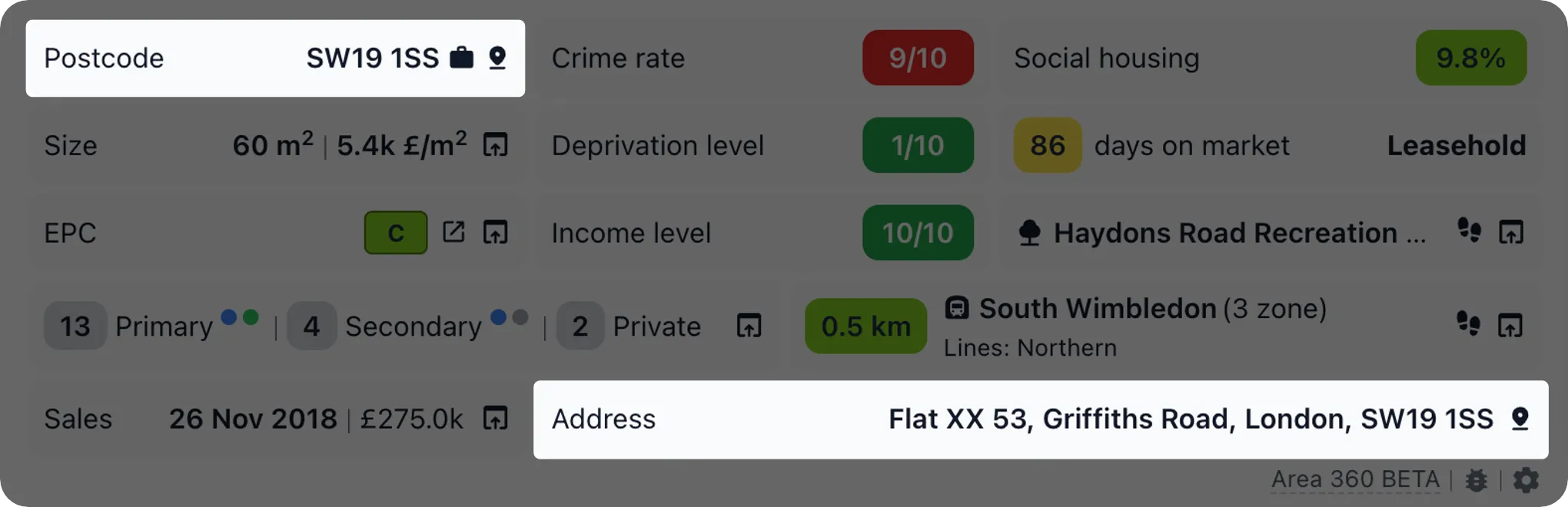
Detailed insights specific to the exact address & postcode, including a quick link to map view of the area and commute route to feature location (eg work).
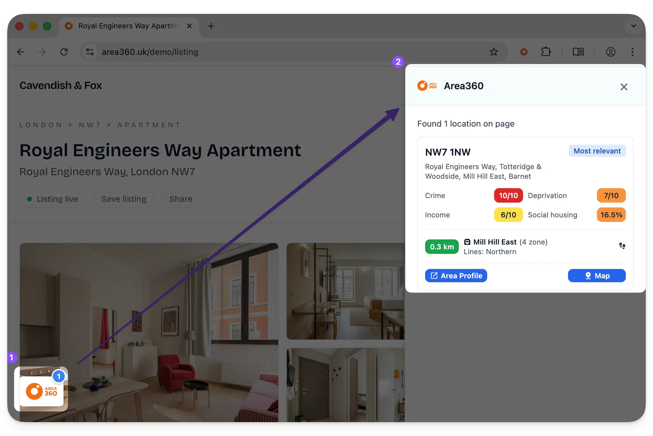
Detects UK addresses, postcodes, and map coordinates on almost any page. When a likely location is found, Area360 adds a small control so you can open Google Maps or the Area360 area profile in one click. If it does not show automatically, run a manual search from the extension menu.
More about this feature: Find Any Location in One Click - On Any Website.
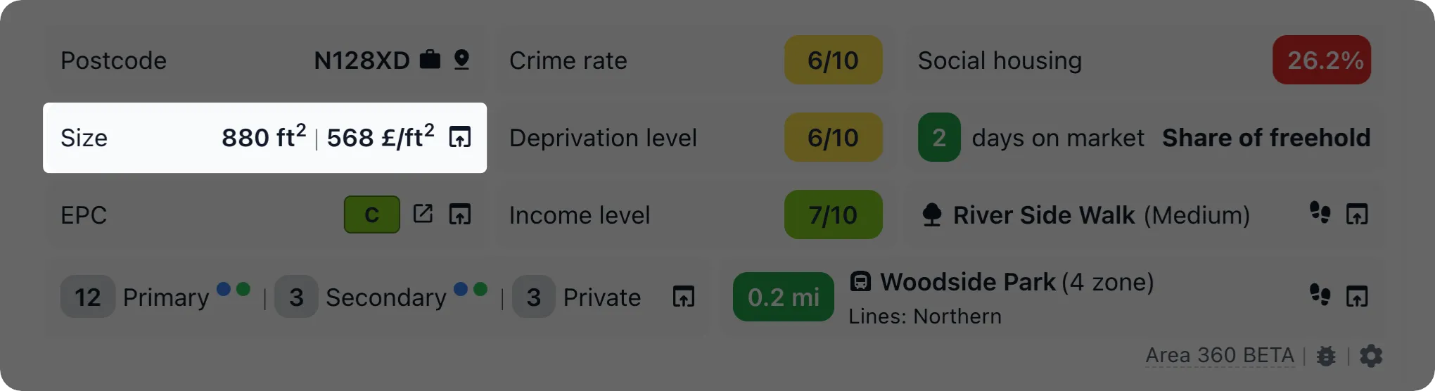
Comprehensive data on the property’s size, including total floor area in square metres or feet. Price per square metre to help assess value compared to similar properties in the area. Graphs showing price trends for properties with similar floor areas.
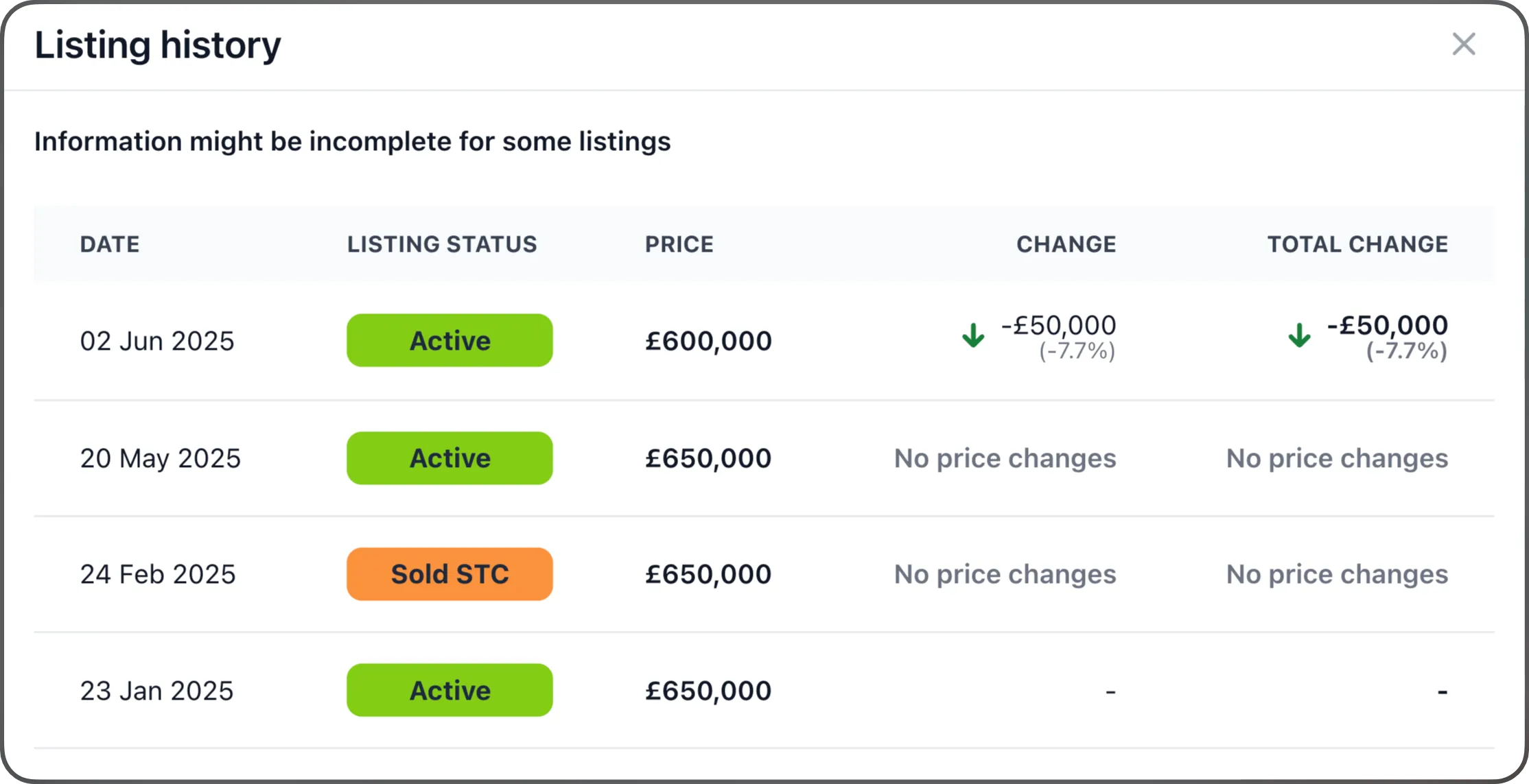
Tracking how many times seller changed price and identify stale listings that repeatedly return to the market, uncover potential price manipulation tactics, and assess the risk of chain breakdowns or gazumping.
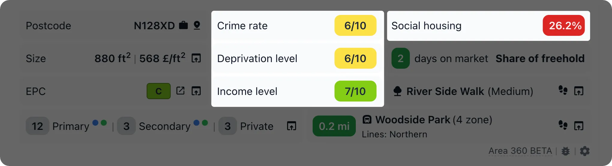
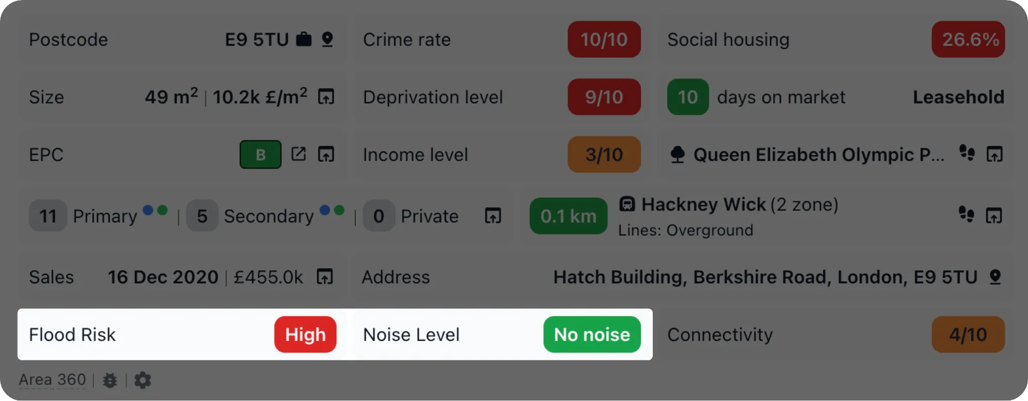
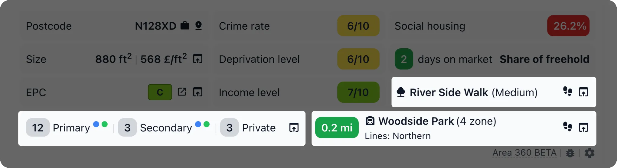
The area data provides a snapshot of key socio-economic and safety indicators, including crime rate. It also highlights the area’s deprivation level, reflecting its socio-economic status, alongside average income figures to offer a glimpse into the local economy. Additionally, the proportion of social housing in the area is detailed, providing insights into the housing mix and community structure.
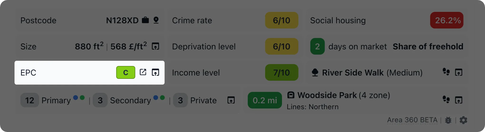
Information about the property’s energy efficiency rating, providing insight into its current performance.
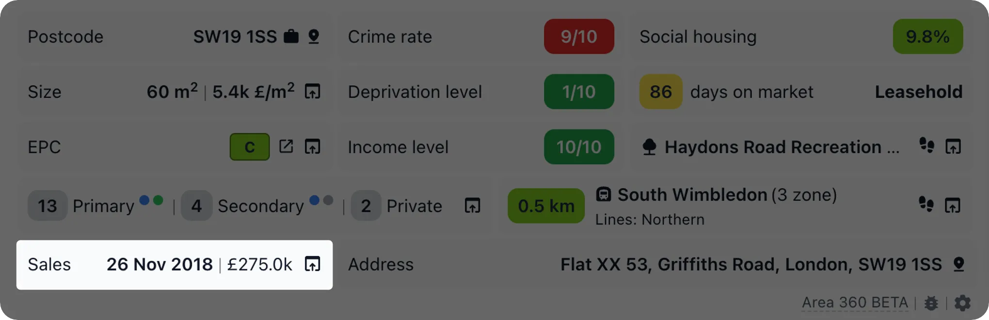
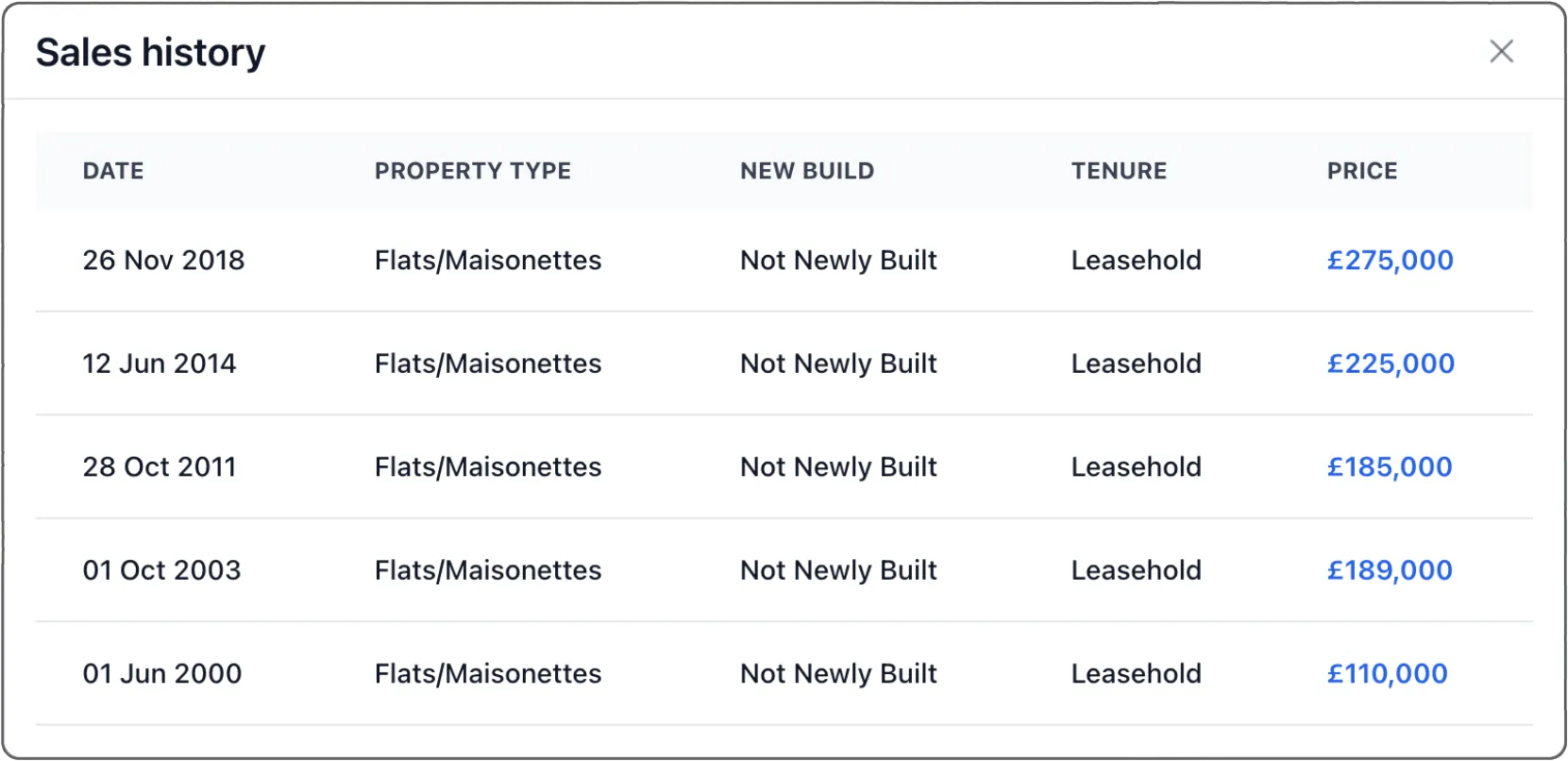
Understand a property’s journey with access to its full sales history. See when it was last sold, for how much, and track price trends over time – perfect for comparing market values and making data-driven decisions.
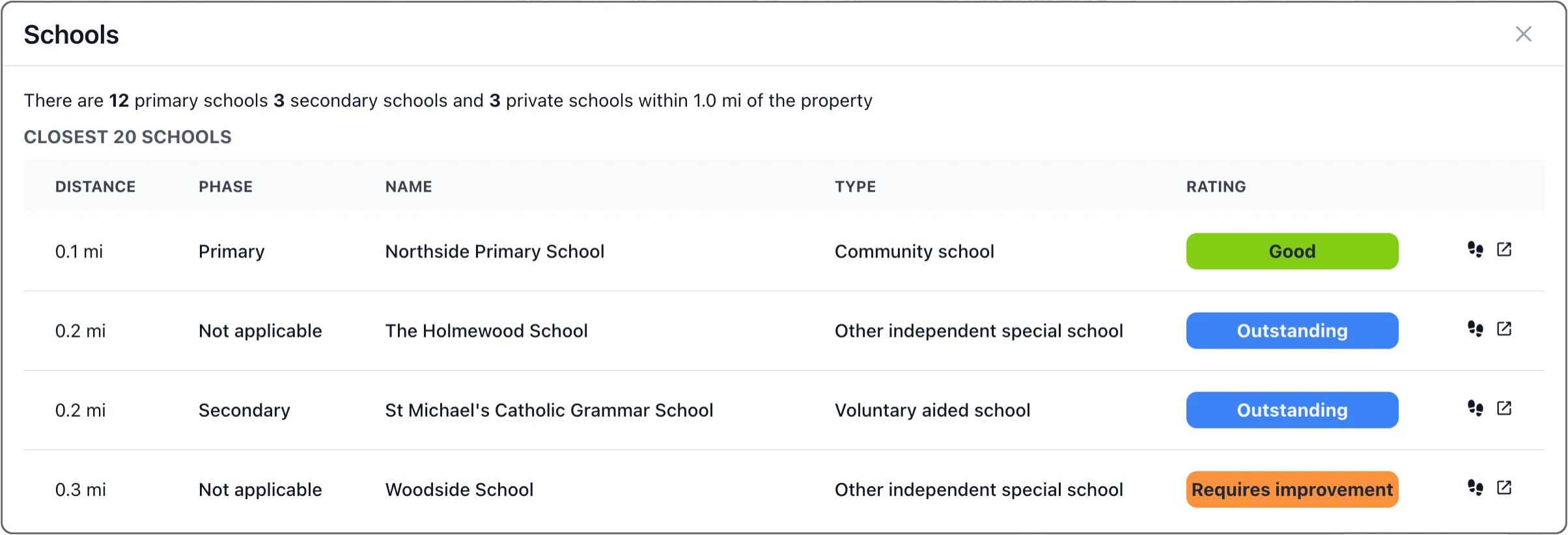
| Schools with Ofsted Ratings |
|---|
 |
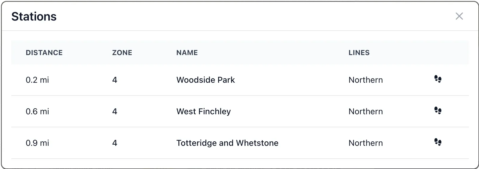
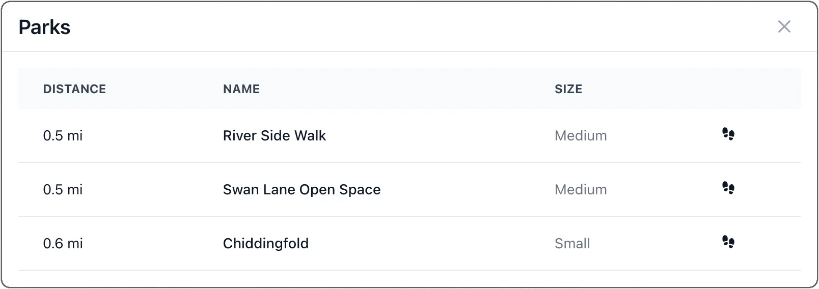
| Transport | Parks |
|---|---|
 |  |